Serving the Flathead Valley & Montana since 2006. A reality based independent journal of observation & analysis. © James Conner.
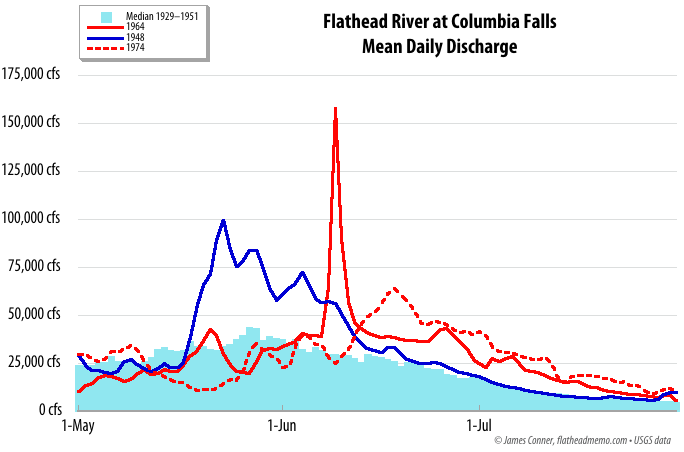
The great Flathead flood of 1964 began with a once in a century gullywasher parked over the continental divide — and ended with the highest water ever for the Flathead River north of Flathead Lake, and the highest water in Flathead Lake since Hungry Horse Dam was closed in 1951.
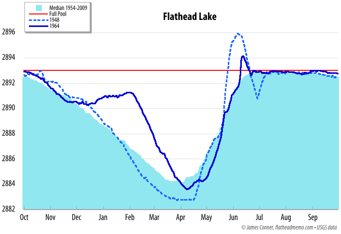
Interestingly, the flood of 1948, which peaked at 102,000 cubic feet per second at Columbia Falls, pushed Flathead Lake to 2895.93 Somers Datum, almost two feet higher than did the flood of 1964, when the Flathead River peaked at 176,000 cfs at Columbia Falls. That’s because the flood of 1964 lasted only a few days while the 1948 magnitude floods of 1948, 1933, 1928, and 1916 lasted longer and pushed the lake to approximately 2896. The flood of 1927 may have been comparable to 1948, but no records are available for the critical period. In 1894, the river peaked at 142,000 cfs and the lake may have reached 2900.
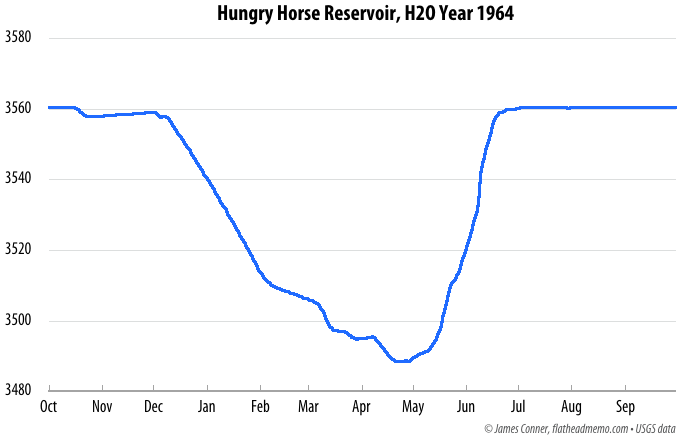
Below are hydrographs of the Flathead River at Columbia Falls for the floods of 1948 and 1964, their effect on Flathead Lake, and a hydrograph of the reservoir behind Hungry Horse Dam. At the peak of the 1964 flood, the reservoir rose five feet a day, a very rare rate of fill. Hydrographs of other Flathead floods are available on my great floods of the Flathead page.
The U.S. Geological Survey’s extensive report (PDF, 20 MB) on the Montana floods of 1964 is a fascinating read, as is the USGS’s report on quantifying bank storage in Hungry Horse Reservoir. The latter report includes historical information on Hungry Horse Dam. Eric Stene wrote a history of the Hungry Horse project (PDF). And a USGS history of the northwest flood of 1948 is available as a PDF (download).