Note, 2 January 2007. This section is being rebuilt, and will be recast in the Flathead Memo format. In the meantime, so that the images stay on the internet, I'making available the Flathead from Space pages from my old www.pixeljim.com website. NASA posts on its websites images from manned space flights dating from the Mercury program through the International Space Station. NASA selected approximately 500 of the most striking images taken from the space shuttles for a special collection, Earth from Space. Several images of Flathead Lake and the territory around it are included in this collection. Many more images of the Flathead are available from NASA's Gateway to Astronaut Photography of Earth. The best images resolve a considerable amount of detail, but the quality is not as good as what can be obtained from a high flying aircraft equipped with high resolution cameras, or from an unmanned imaging satellite. In many of NASA's images, terrestrial objects are low in contrast, have a bluish cast, and greatly benefit from contrast and color enhancement. Below, I present several images that I enhanced. Most of the enhanced images are available as higher resolution files designed for printing. I recommend setting the file resolution to 180 pixels per inch, and choosing a printer output resolution of 1440 dots per inch or higher. To view the large images, click on the blue image number. | |||
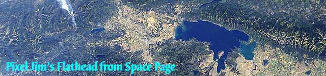
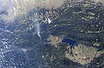
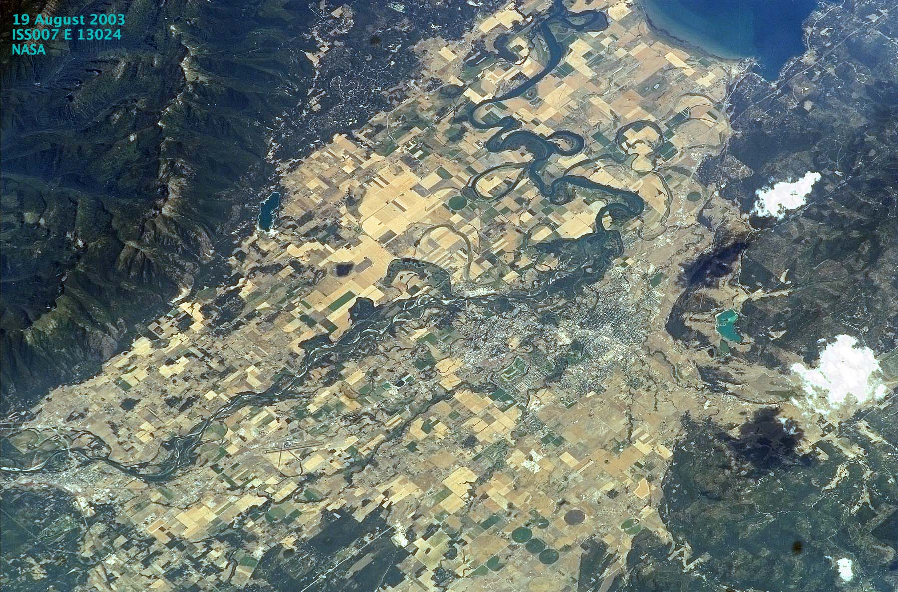
 |  | Image ISS007-E-13024 enhanced, taken from the international space station on 19 August 2003. Flathead Lake is at the top. The Flathead Center Mall is visible to sharp eyes. | |
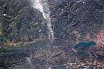
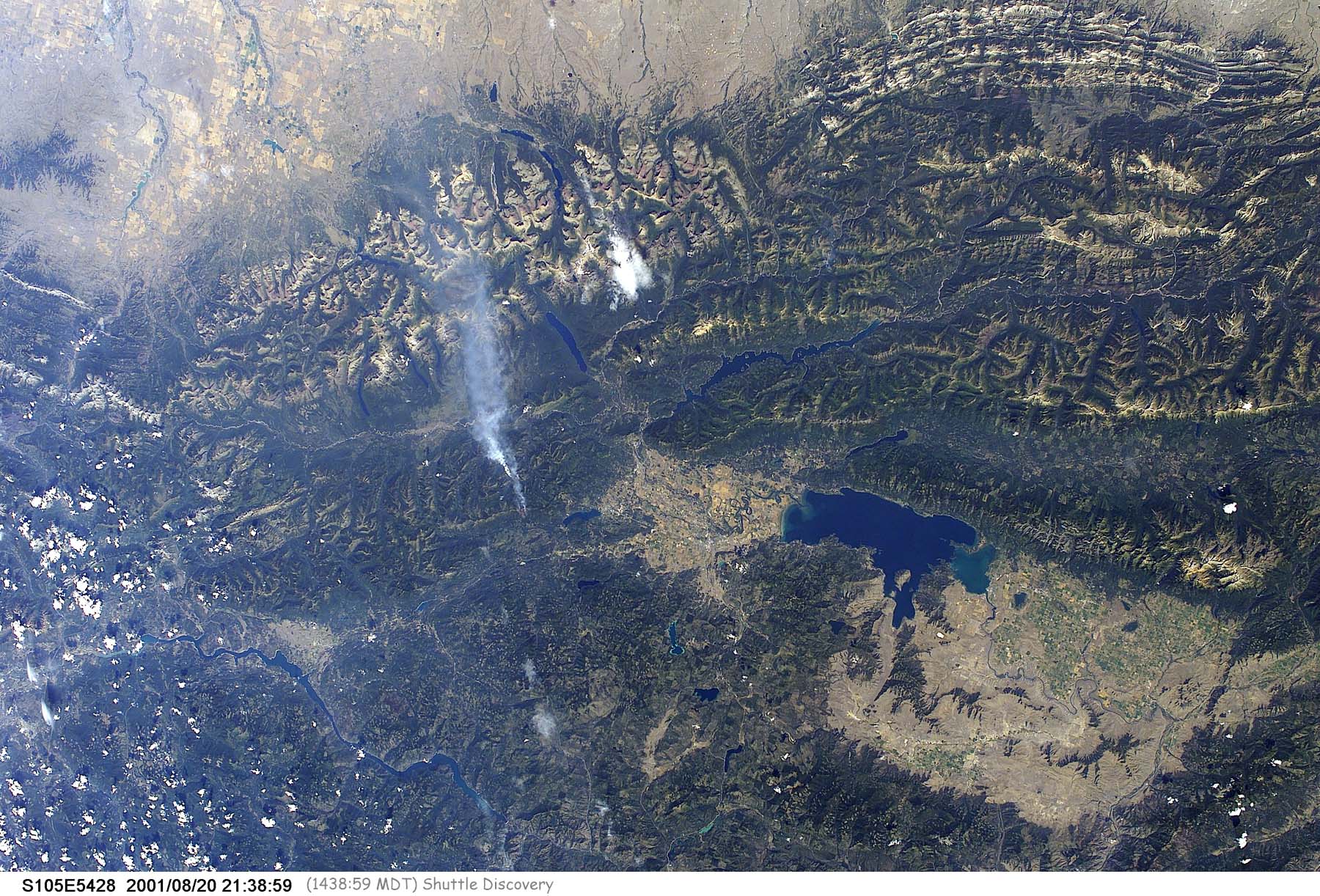
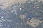 |  | Image S105-E-5428 enhanced, made on 20 August 2001 at 1439 MDT. Smoke from the Moose Creek Fire, still in its infancy, rises northeast of Whitefish. | |
 |  | Close-up of Moose Creek Fire, enhanced. More information on this image will be added later. | |
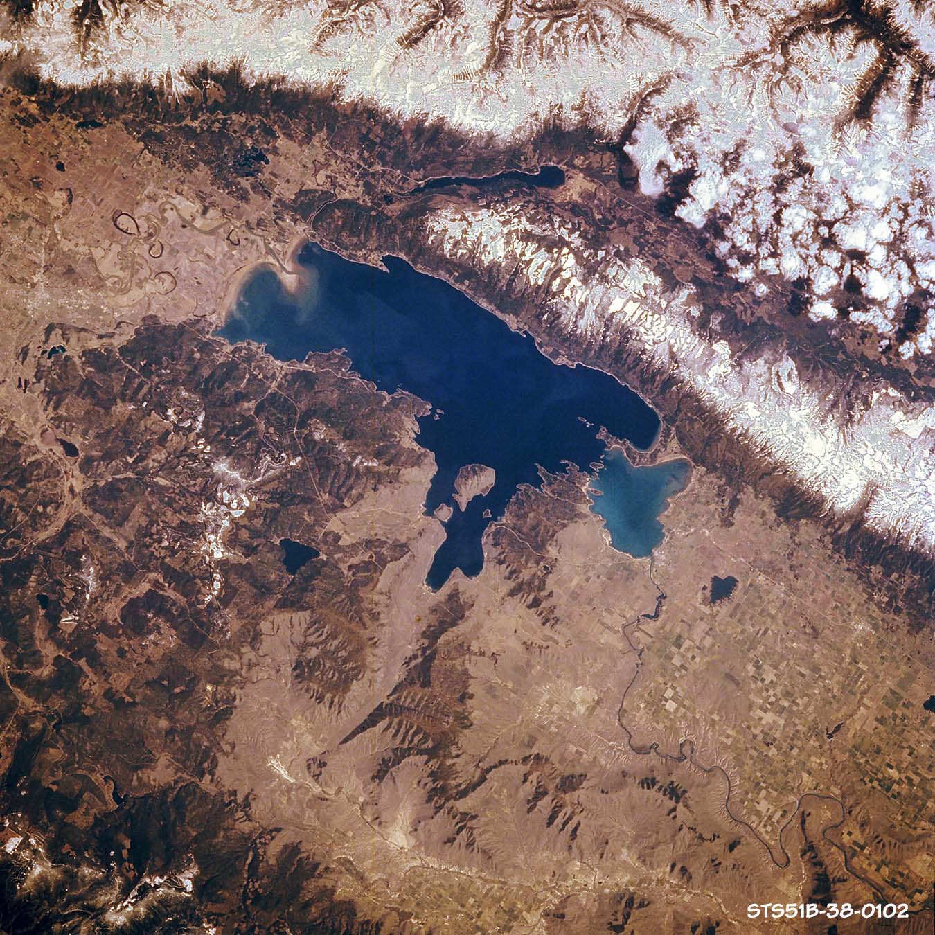
 |  | Image STS51B-038-0102. Taken on 30 April 1985 from the Challenger, on Mission 51B, using a 250mm lens (equivalent to a 135mm lens on a 35mm camera). North is toward the upper left corner. The camera angle is near vertical. The image on the left is the original from 1997. Note the bluish cast and low contrast. The image on the right is the one that NASA supplies today. | |
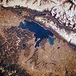 | Image STS51B-038-0102, enhanced.The bluish cast is gone and there is more contrast. Note the differences in color in Flathead Lake, which correspond to depth. Shallow Polson Bay is markedly lighter than the rest of the lake. The enhancement technique involves a combination of masking, histogram stretching, selective equalization, some color correction, and sharpening. | ||
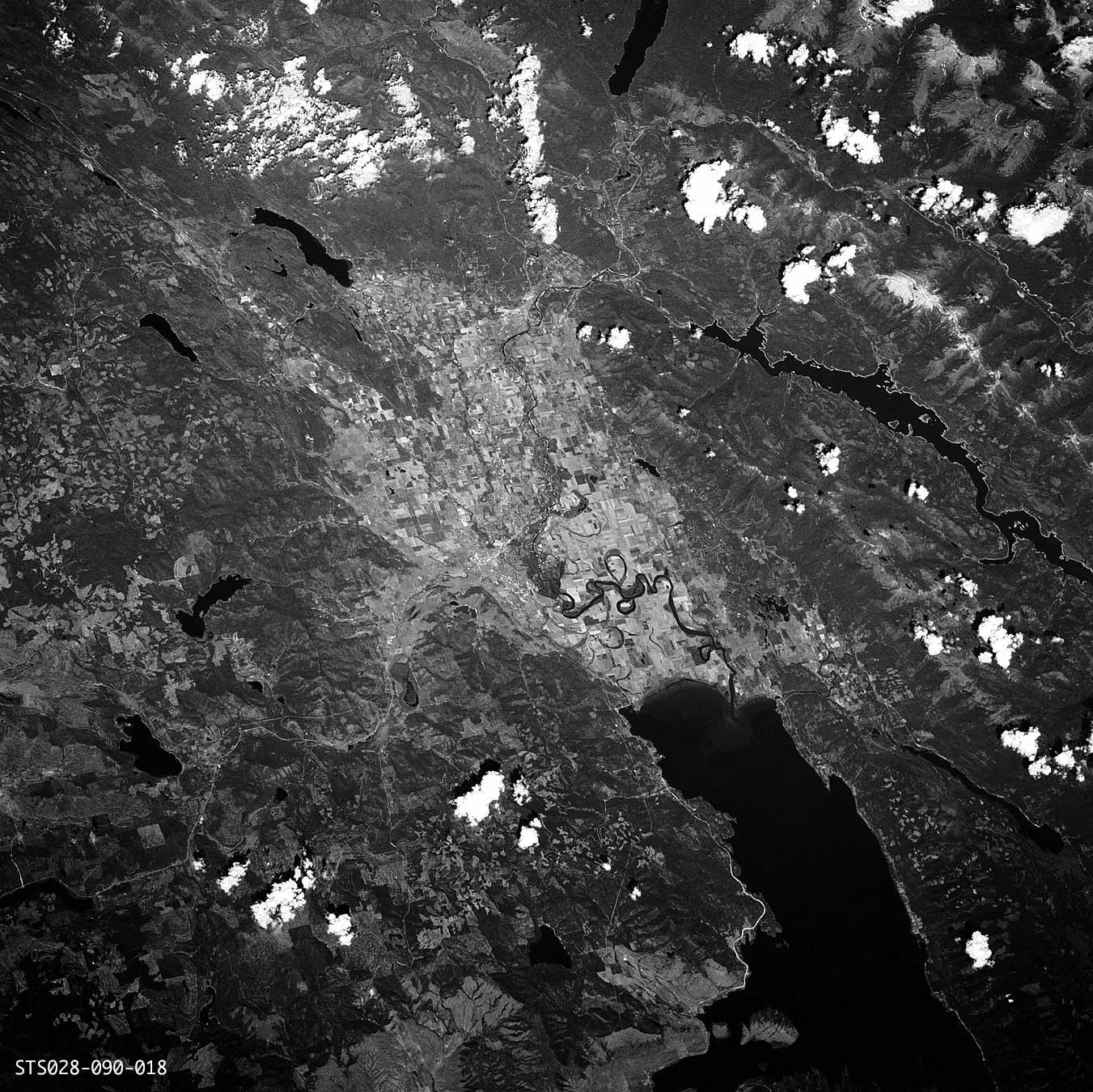
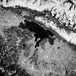 |  | Image STS51B-038-0102, grayscale. A combination of the red and green channels synthesizes the effect of shooting black-and-white film through a yellow "minus blue" filter (Wratten #12). Note how little is lost when the color is removed. But when the luminosity (grayscale) information is set to a uniform value (50 percent gray), contrast and depth are eliminated almost entirely. | |
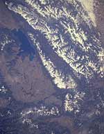
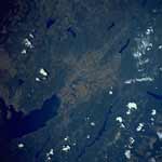
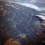
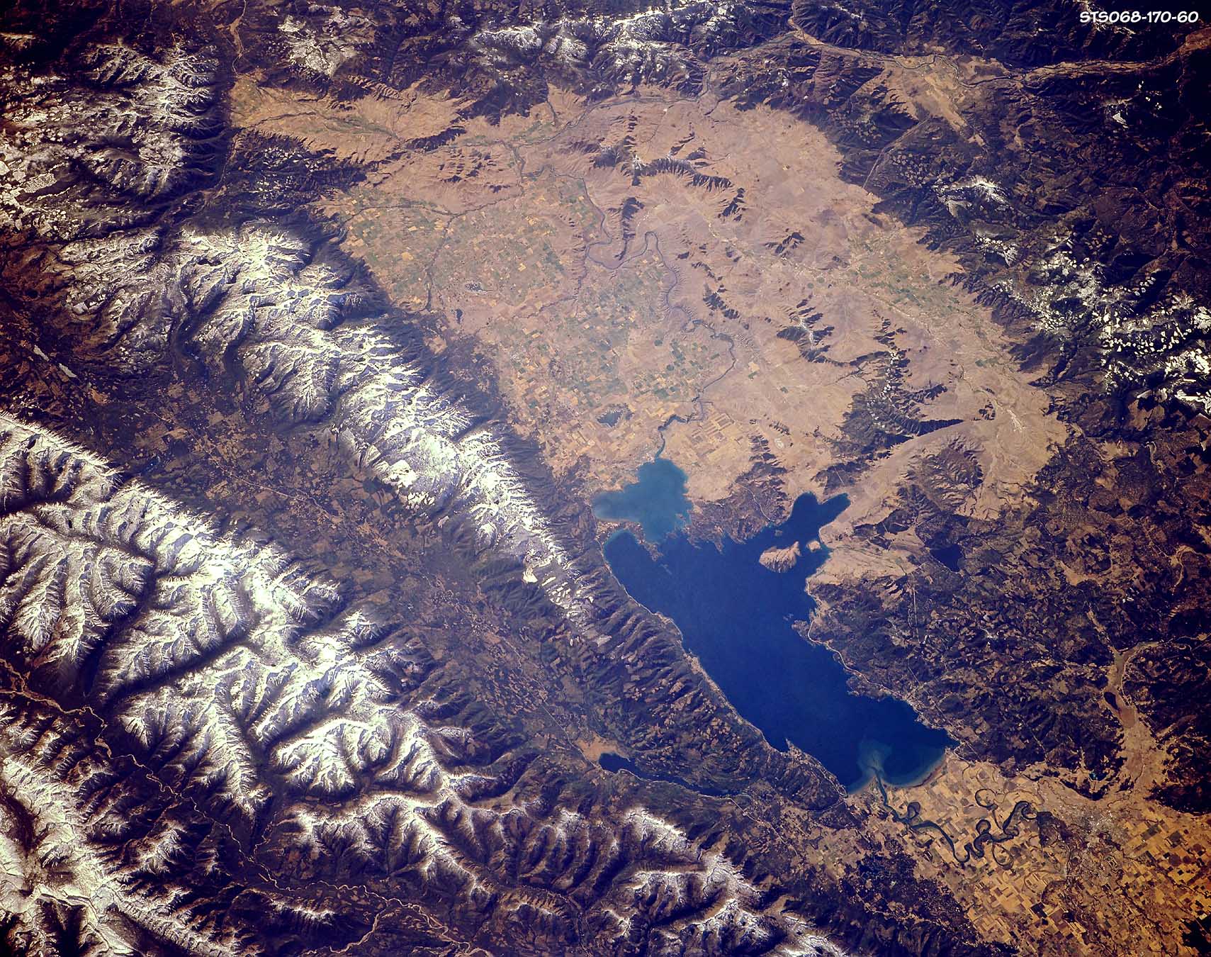
 |  | Image STS068-170-060, enhanced. Taken in late September, 1994, from the shuttle Endeavour, on Mission 68, using a 250mm lens. North is toward the bottom right corner. The camera tilt is low oblique and the altitude is 116 nautical miles. Further enhancements of the Swan Valley reveal the extent of land modification. Far left, original image. | |
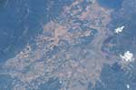
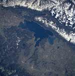
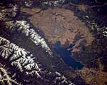
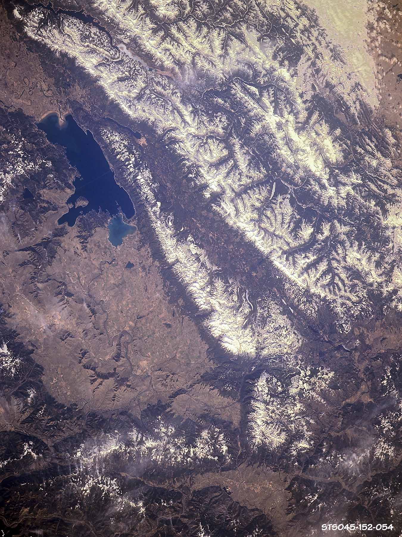
 | 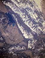 | Image STS045-152-054, enhanced. Made on 28 March 1992 from the shuttle Atlantis, on Mission 45, using a 250mm lens. North is toward the upper left corner. The camera tilt is low oblique, and the altitude is 164 nautical miles. The high resolution version of this image expands to 59.4 megs. In this image, both the Flathead and the Rocky Mountain Front are visible, as are the Mission and Jocko Valleys. Far left, original image. | |
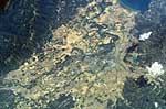
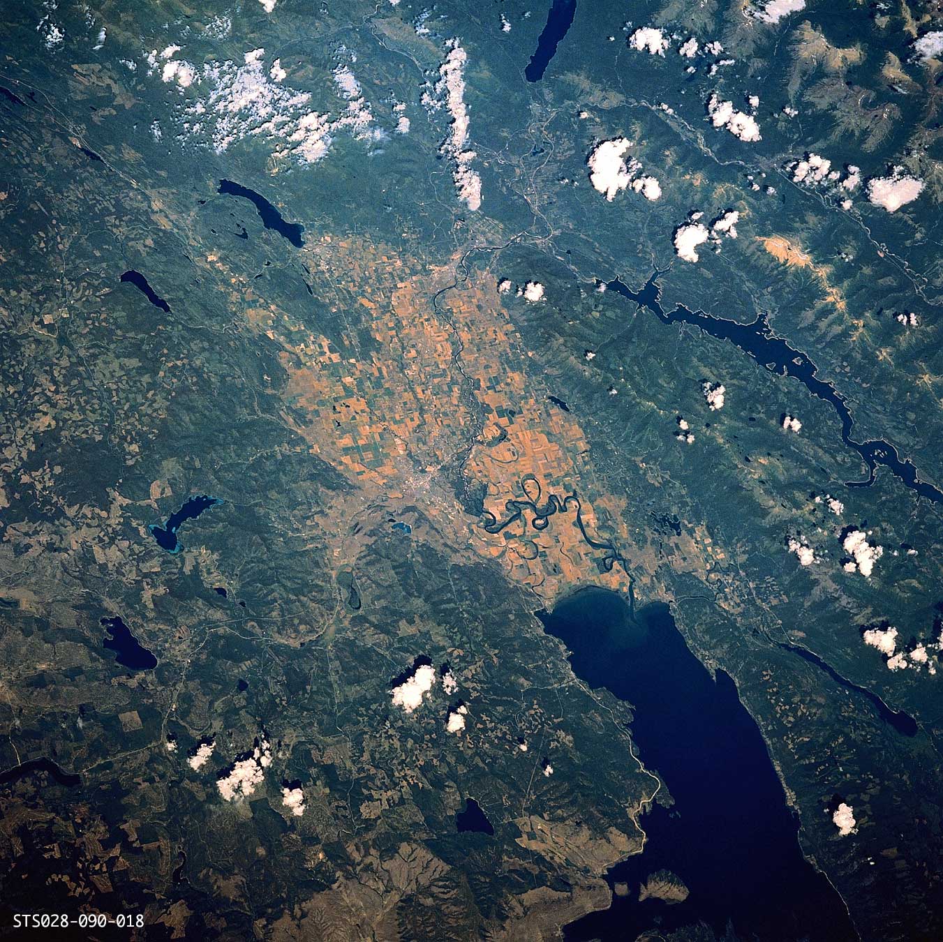
 |  | Image ST028-90-018. Made in early August, 1989, from the shuttle Columbia, on Mission 28 (the fourth Department of Defense mission), using a 250mm lens. North is toward the upper right corner. The camera tilt is low oblique, and the altitude is 162 nautical miles. Far left, the scan provided by NASA in 1997. Note the bluish cast and low contrast. Left, the scan provided in 2002 is dark, but not as blue, and has been rotated 90 degrees counterclockwise. | |
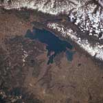
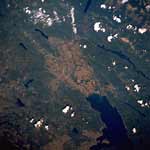
 | Image STS028-90-018, enhanced. A tremendous amount of detail is visible in this image0, which includes Flathead Lake, Swan Lake, Hungry Horse Reservoir, Lake McDonald, Whitefish Lake, Little Bitterroot Lake, Ashley Lake, and Talley Lake. Note the meanders of the Flathead River as it approaches Flathead Lake. A grayscale version for printing also is available. | ||
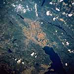
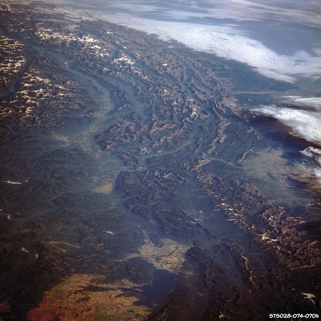
 | Image STS028-074-070. Made in early August, 1989, from the shuttle Columbia, on Mission 28 (the fourth Department of Defense mission), using a 250mm lens. North is pretty much straight up. The camera angle is low oblique and a 250mm lens was employed. Flathead Lake is bottom, middle. I'm indebted to Helena based GIS expert Ed Madej for steering me to this image. The high resolution version of this images is 5,000+ pixels square and expands to 80 megabytes. | ||
Copyright 2004, James R. Conner, all rights reserved. | |||